


 CATALOG
 CONTACT
 ABOUT


C-MAP DISCOVER X - EAST MEDITERRANEAN
-
Code:NAV-M-EM-T-111-D-MS
-
Weight:0.000 Kgs
Experience the new era of navigation with C-MAP DISCOVER X! Enjoy dynamic charts with the latest vector data, superior Day & Night modes, and detailed High-Res Bathymetry.
- Seamless Simrad App Integration
- Subscription-Free Auto Routing
- New Map Inspector Tool for quick access to vital info.
Quick Buy

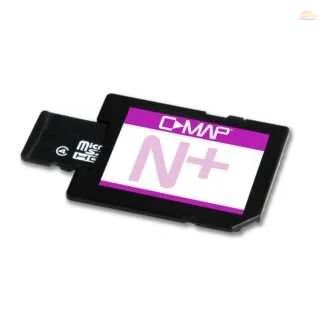
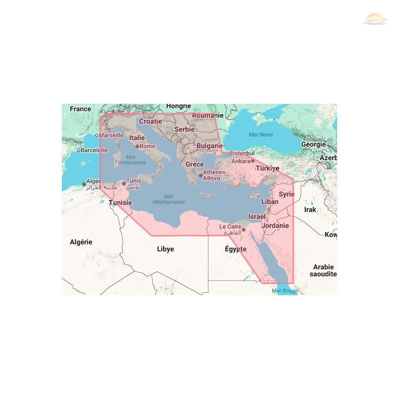
Embark on a new era of marine navigation with the C-MAP DISCOVER X - EAST MEDITERRANEAN chart. This isn't just a chart; it's your gateway to a richer, more dynamic on-the-water experience, exclusively designed for Simrad NSX.
Next-Generation Chart Experience
Experience a revolutionary approach to chart presentation that redefines clarity and ease of use. The C-MAP DISCOVER X ensures that vital information is always at your fingertips, dynamically optimized at every zoom level to eliminate clutter and enhance situational awareness.
- Optimized Data Presentation: Enjoy the best possible on-the-water navigation with a clear and concise chart display.
- Dynamic Zoom Levels: Access the data you need, when you need it, with intelligent optimization at every zoom level.
- Best-in-Class Day & Night Modes: Navigate safely and confidently, regardless of weather conditions or time of day, thanks to superior visibility.
Seamless App Integration
Stay connected like never before with seamless integration with the Simrad Companion App. Plan, review, and sync your adventures effortlessly, ensuring you're always prepared.
- Trip Planning & Syncing: Plan routes, review tracks, and plot waypoints on the app, then sync directly to your NSX.
- Direct Access to Resources: Access NSX manuals, "How To" guides, and more, directly from the app for on-the-go support.
- The Future is Connected: With C-MAP & Simrad, you'll be ready for the next wave of connected marine technology.
Unrivaled C-MAP Features
Benefit from the best of C-MAP technology, designed to provide you with the most detailed and accurate chart data available. Make the most of your time on the water with features crafted for both seasoned mariners and weekend adventurers.
- Full-Featured Vector Charts: Navigate with confidence using accurate, up-to-date vector chart details sourced from official hydrographic offices.
- High-Res Bathymetry: Discover hidden underwater structures with precise contours down to 1-foot, leveraging the best of C-MAP HRB data to identify shallows, drop-offs, and more.
- Subscription-Free Auto Routing: Automatically calculate the safest and most efficient routes based on detailed chart data and your vessel's specifications - no subscription required.
- Custom Depth Shading: Enhance your situational awareness by setting custom depth shading, highlighting safe zones or optimizing your fishing strategy.
- Harbor & Approach Details: Approach any harbor or inlet with confidence, utilizing detailed layouts of marinas, including slip spaces, restricted areas, and other essential information.
Innovative Map Inspector Tool
Access the information you need instantly with the new Map Inspector Tool. A simple touch of the screen provides critical insights for informed decision-making.
- Tides & Currents: Plan your day with detailed projections of water levels and tidal data, ensuring you're always in sync with the sea.
- Detailed Marina Port Plans: Dock with ease in unfamiliar ports using precise layouts of thousands of marinas, including slip spaces and restricted areas.