


 CATALOG
 CONTACT
 ABOUT


C-MAP Reveal X Eastern Mediterranean Map.
-
Code:NAV-M-EM-T-111-R-MS
-
Weight:0.000 Kgs
Explore the Eastern Mediterranean with the C-MAP Reveal X! This Micro SD card provides detailed, up-to-date vector charts without an annual subscription. Benefit from shaded relief, high-resolution bathymetry, and Easy Routing™. Enjoy aerial photography and satellite overlay for enhanced navigation. Compatible with B&G and Simrad models.
- No Annual Subscription
- High-Resolution Bathymetry
- Easy Routing™
Quick Buy

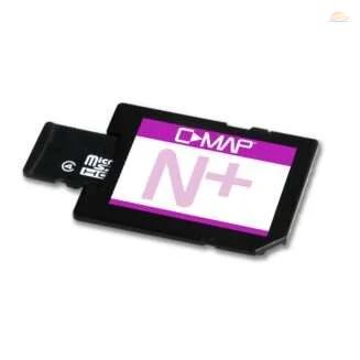
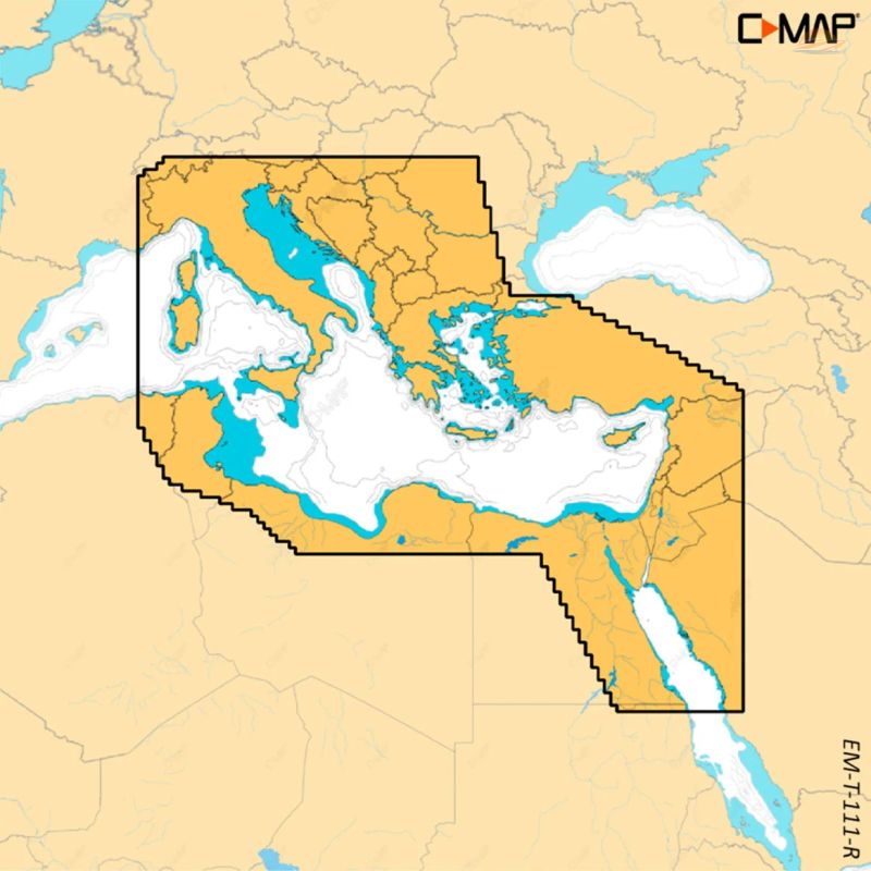
C-MAP Reveal X Eastern Mediterranean Map
Navigate the Eastern Mediterranean with confidence and clarity using the C-MAP Reveal X Eastern Mediterranean Map. This Micro SD card provides detailed and accurate cartography without the burden of an annual subscription for its core features, offering exceptional value and peace of mind for your voyages.
Key Features and Benefits:
Stunning Visuals with Shaded Relief:
Experience the underwater world like never before. Shaded Relief brings both land and underwater elevations to life with 3D rendering, including detailed bathymetric seabed areas. This feature enhances your situational awareness, making navigation more intuitive and enjoyable.
Full-Featured Vector Charts:
Benefit from accurate, up-to-date vector chart details. These charts simplify navigation by providing clear and precise information, ensuring you have the data you need at your fingertips.
High-Resolution Bathymetry:
Identify potential hazards with ease. High-resolution bathymetry, enhanced with Genesis® detail, helps you locate shallow areas, drop-offs, and holes, ensuring safer passage through unfamiliar waters.
Custom Depth Shading:
Tailor your view to your specific needs. Set a clear safe depth, maintain a traditional paper-like view, or create your own custom shading to highlight areas of interest. This flexibility allows you to optimize the display for any situation.
Effortless Navigation with Easy Routing™:
Let the C-MAP Reveal X chart do the work for you. Easy Routing™ automatically plots the shortest and safest route based on detailed map data and your boat's specifications. Save time and reduce stress with this intelligent routing feature.
Enhanced Awareness with Aerial Photography:
Gain an extra level of detail with thousands of aerial photographs of harbors, bays, and other notable navigation features. These high-quality images provide valuable context, helping you make informed decisions.
Satellite Overlay for Real-World Perspective:
Stay informed about your surroundings in unfamiliar locations. The satellite overlay provides a real-world perspective, helping you orient yourself and understand the environment around you.
Tide Information:
Access crucial tidal information directly on your chartplotter. The C-MAP Reveal X displays forecasts of water levels and tide direction, helping you plan your trips and navigate safely.
Detailed Marina Plans:
Docking in unfamiliar harbors becomes stress-free with detailed marina plans. These plans include precise layouts of skipper spots, restricted areas, and other valuable navigation information, ensuring a smooth and safe arrival.
Compatibility:
Seamlessly integrates with popular sonar systems, including B&G Zeus S model, Simrad NSX, Simrad NSX ULTRAWIDE, and Simrad NSS 4 models, ensuring optimal performance and functionality.
- No Annual Subscription Required: Enjoy core features without recurring fees.
- Detailed Cartography: Accurate and up-to-date mapping of the Eastern Mediterranean.
- Enhanced Awareness: Shaded Relief, Aerial Photography, and Satellite Overlay provide comprehensive situational awareness.
- Safe Navigation: High-Resolution Bathymetry and Custom Depth Shading help you avoid hazards.
- Easy Routing™: Automatically plot the safest and shortest routes.