


 CATALOG
 CONTACT
 ABOUT


C-MAP Reveal X Black & Caspian Sea Map
-
Code:NAV-M-EM-T-112-R-MS
-
Weight:0.000 Kgs
Explore the Black & Caspian Seas with the C-MAP Reveal X Micro SD card! This map is packed with features to enhance your navigation, offering shaded relief, high-resolution bathymetry, and full-featured vector charts for accurate details. Plus, there's no annual subscription needed to access all special features! Enjoy detailed marina plans, easy routing, aerial photography, satellite overlay and tides.
- Shaded Relief: 3D rendered land and underwater elevation.
- Easy Routing™: Automatically plot the safest route.
- No Subscription: Access all features without extra fees.
Quick Buy

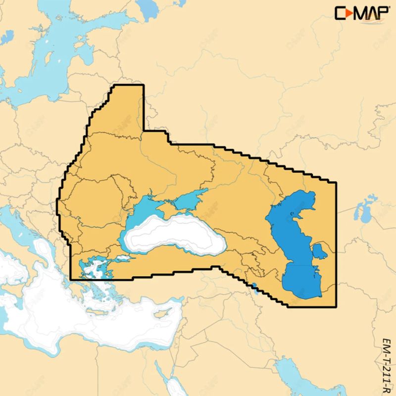
C-MAP Reveal X Black & Caspian Sea Map
Navigate the Black & Caspian Seas with unparalleled detail and clarity using the C-MAP Reveal X chart. This Micro SD card provides comprehensive, up-to-date cartography without requiring an annual subscription for its core features, giving you peace of mind and exceptional value.
Key Features
Unlock a new level of situational awareness and navigation confidence with these powerful features:
Shaded Relief: Experience the Black & Caspian Seas like never before. 3D rendered land and underwater elevation, including detailed bathymetric seabed areas, bring the world around you to life, enhancing your understanding of the terrain.
Full-featured Vector Charts: Navigate with ease using accurate, up-to-date vector chart details. These charts provide clear and concise information, making navigation simpler and safer.
High-resolution Bathymetry: Pinpoint shallow areas, drop-offs, and holes with incredible precision. The high-resolution bathymetry, enhanced with Genesis® detail, helps you identify key fishing spots and potential hazards.
Custom Depth Shading: Tailor your view to your specific needs. Set a clear safe depth, maintain a traditional paper-like view, or create your own custom shading scheme to highlight areas of interest.
Easy Routing™: Save time and fuel with the intelligent Easy Routing™ feature. Automatically plot the shortest and safest route based on detailed map data and your boat's specific information.
Aerial Photography: Gain an extra level of detail with a vast collection of aerial photographs. Thousands of photos of harbors, bays, and other notable navigation features are included to help you approach unfamiliar locations with confidence.
Satellite Overlay: Get a clear understanding of your surroundings, even in unfamiliar locations. The satellite overlay provides valuable visual context, enhancing your situational awareness.
Tides: Stay informed about changing water levels. Access forecasts of water levels and tide direction to plan your activities effectively.
Detailed Marina Plans: Docking in an unfamiliar harbor is now stress-free. Precise marina plans, including skipper spots, restricted areas, and other valuable navigation information, are readily available.
Compatibility
The C-MAP Reveal X Black & Caspian Sea Map is compatible with a range of leading sonar systems, including:
- B&G Zeus S model
- Simrad NSX
- Simrad NSX ULTRAWIDE
- Simrad NSS 4 models
Enhance your boating experience with the C-MAP Reveal X Black & Caspian Sea Map – your essential tool for safe and informed navigation.