CATALOG
 CONTACT
 ABOUT


C-MAP NAVI MAPS
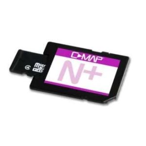

C-MAP REVEAL MIDDETERANIAN AND BLACK SEA
Explore the Eastern Mediterranean, Black, and Caspian Seas with the C-MAP Reveal Chart. This micro SD card delivers accurate, up-to-date vector chart detail, bringing navigation to life with 3D rendered land and underwater elevation. Note: This chart does NOT include an annual subscription for special features.
- High-Resolution Bathymetry: Identify shallow areas and drop-offs easily.
- Easy Routing™: Automatically plot the safest routes.
- Aerial Photography: Thousands of photos of harbors and bays.
In stock
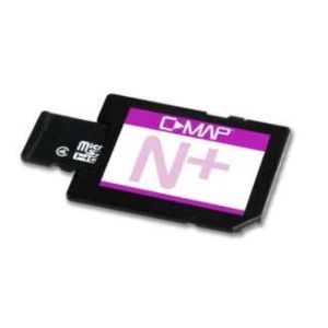
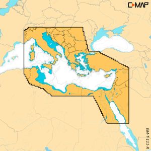
C-MAP Reveal X Eastern Mediterranean Map.
Explore the Eastern Mediterranean with the C-MAP Reveal X! This Micro SD card provides detailed, up-to-date vector charts without an annual subscription. Benefit from shaded relief, high-resolution bathymetry, and Easy Routing™. Enjoy aerial photography and satellite overlay for enhanced navigation. Compatible with B&G and Simrad models.
- No Annual Subscription
- High-Resolution Bathymetry
- Easy Routing™
In stock
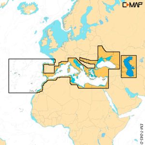
C-MAP Discover Southern Europe Map
Navigate Southern Europe's waters with confidence using the C-MAP Discover chart. This Micro SD card provides detailed vector charts, high-resolution bathymetry with Genesis® detail, and custom depth shading. The Easy Routing™ feature helps you plot the safest route, while aerial photography and detailed marina plans enhance your navigational experience. Plus, get tide forecasts for accurate planning. Please note, it does NOT include an annual subscription for special features.
- Full-featured vector charts
- High-resolution bathymetry
- Easy Routing™
In stock
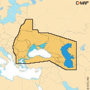
C-MAP Discover X Black & Caspian Sea Map
Navigate the Black & Caspian Seas with confidence using the C-MAP Discover X Micro SD card. Enjoy detailed vector charts, high-resolution bathymetry with Genesis® detail, and custom depth shading. Benefit from Easy Routing™, aerial photography, tide forecasts, and detailed marina plans.
- Full-featured Vector Charts
- High-resolution bathymetry
- Easy Routing™
- No annual subscription for special features
Compatible with B&G Zeus S, Simrad NSX, NSX ULTRAWIDE, and NSS 4 models.
In stock
C-MAP DISCOVER X-SOUTHERN EUROPE
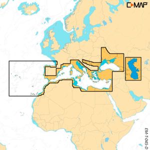
Explore Southern Europe's waters with the C-MAP Discover X Chart! This Micro SD card delivers detailed, up-to-date vector charts for easy navigation. Benefit from high-resolution bathymetry, custom depth shading, and Easy Routing™ for safe passage planning. Enjoy aerial photography, tide forecasts, and detailed marina plans, enhancing your boating experience. Compatible with B&G and Simrad sonars.
- Full-Featured Vector Charts
- High-Resolution Bathymetry
- Easy Routing™
In stock
C-MAP DISCOVER X - EAST MEDITERRANEAN
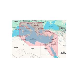
Experience the new era of navigation with C-MAP DISCOVER X! Enjoy dynamic charts with the latest vector data, superior Day & Night modes, and detailed High-Res Bathymetry.
- Seamless Simrad App Integration
- Subscription-Free Auto Routing
- New Map Inspector Tool for quick access to vital info.
In stock
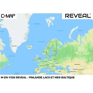
C-MAP REVEAL X - FINLAND INLAND AND BALTIC SEA
C-MAP - REVEAL and REVEAL X charts - EN326 - Finnish Lakes and Baltic Sea
Whether it's cruising, fishing or sailing, C-MAP REVEAL and REVEAL X charts offer the best of C-MAP. The REVEAL series is compatible with Simrad, B&G and Lowrance chartplotters (except Hook and Cruise). The Reveal X series is designed exclusively for the Simrad NSX with the new Android-based interface.
In stock
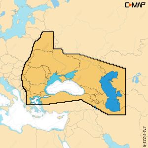
C-MAP Reveal X Black & Caspian Sea Map
Explore the Black & Caspian Seas with the C-MAP Reveal X Micro SD card! This map is packed with features to enhance your navigation, offering shaded relief, high-resolution bathymetry, and full-featured vector charts for accurate details. Plus, there's no annual subscription needed to access all special features! Enjoy detailed marina plans, easy routing, aerial photography, satellite overlay and tides.
- Shaded Relief: 3D rendered land and underwater elevation.
- Easy Routing™: Automatically plot the safest route.
- No Subscription: Access all features without extra fees.
In stock